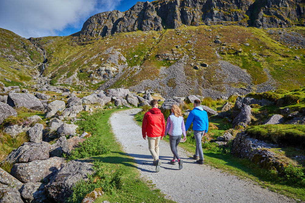
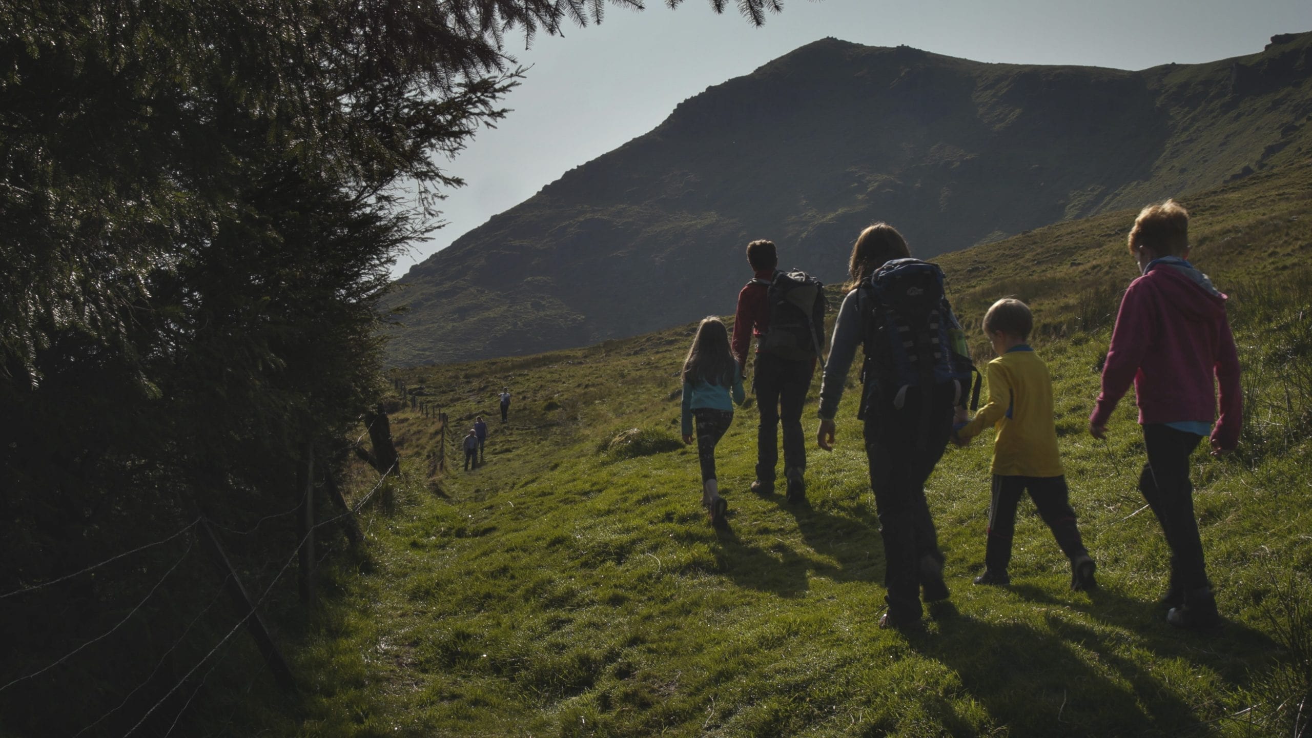
Nire Valley Walks
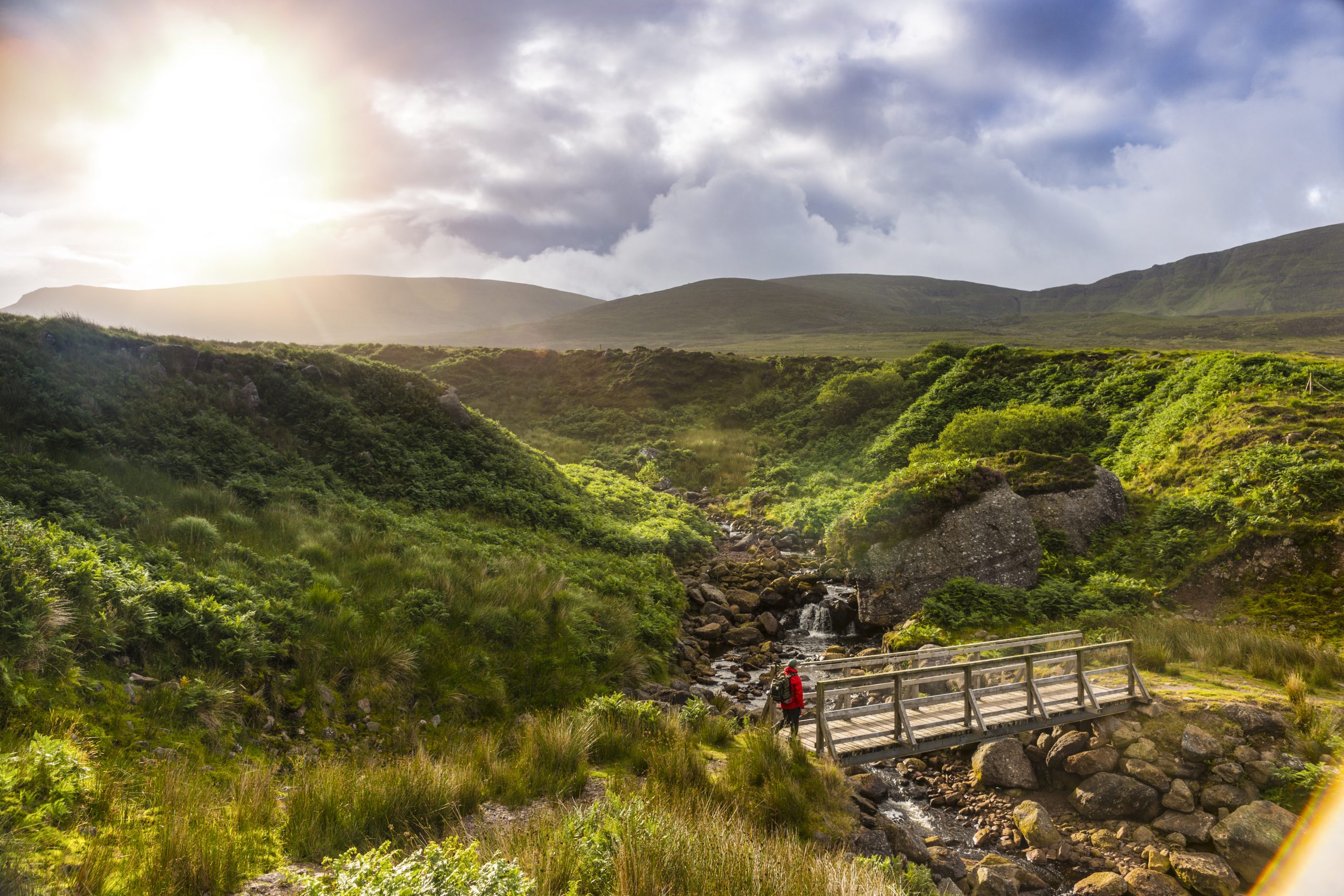
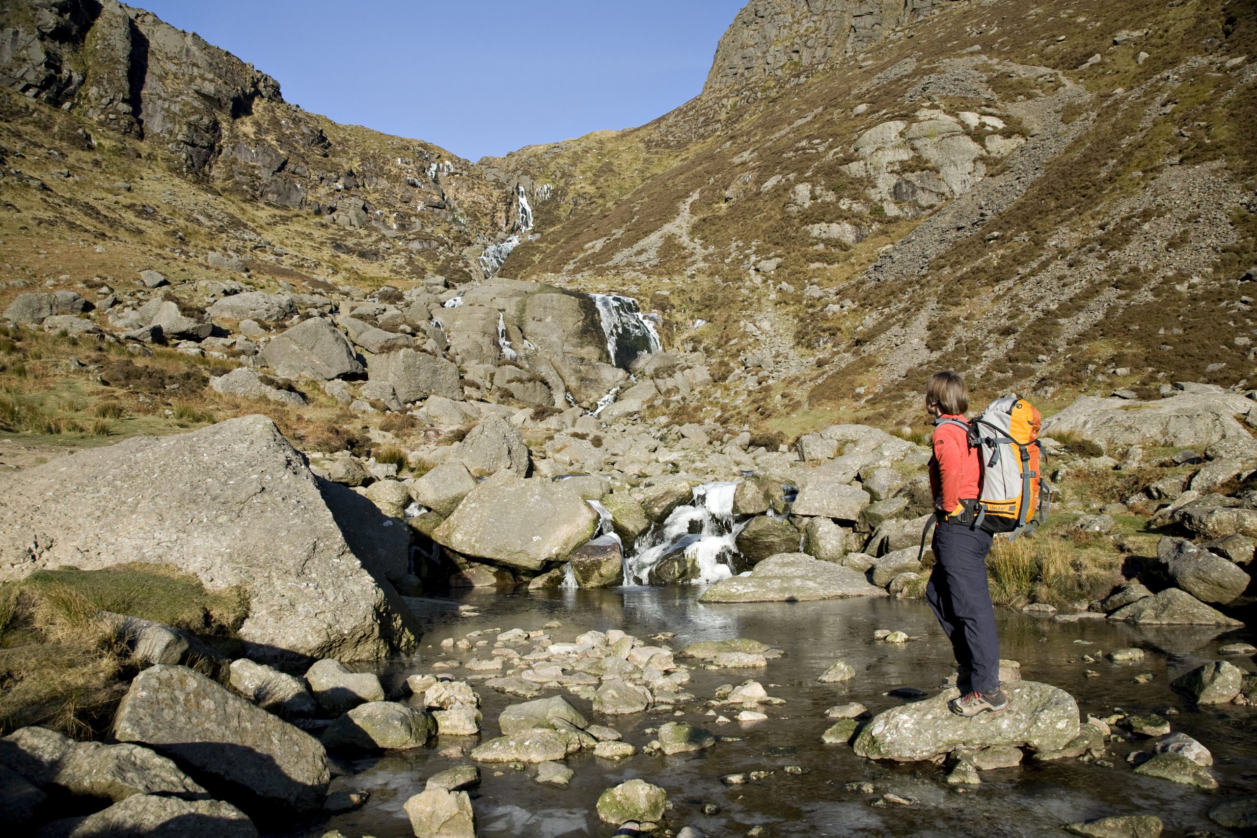
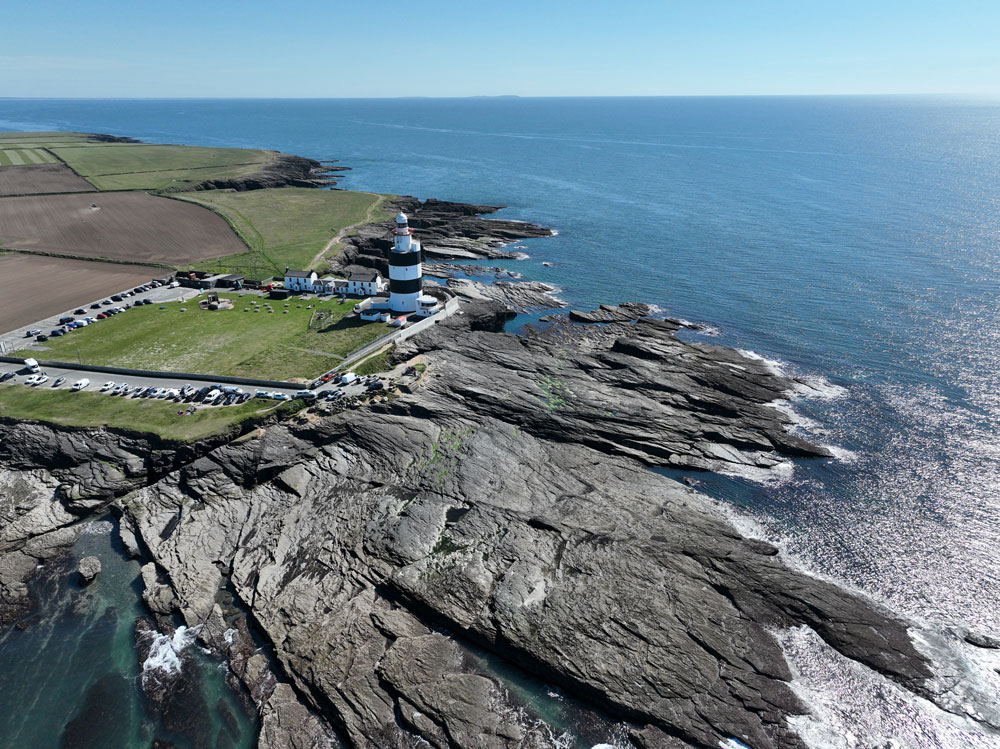
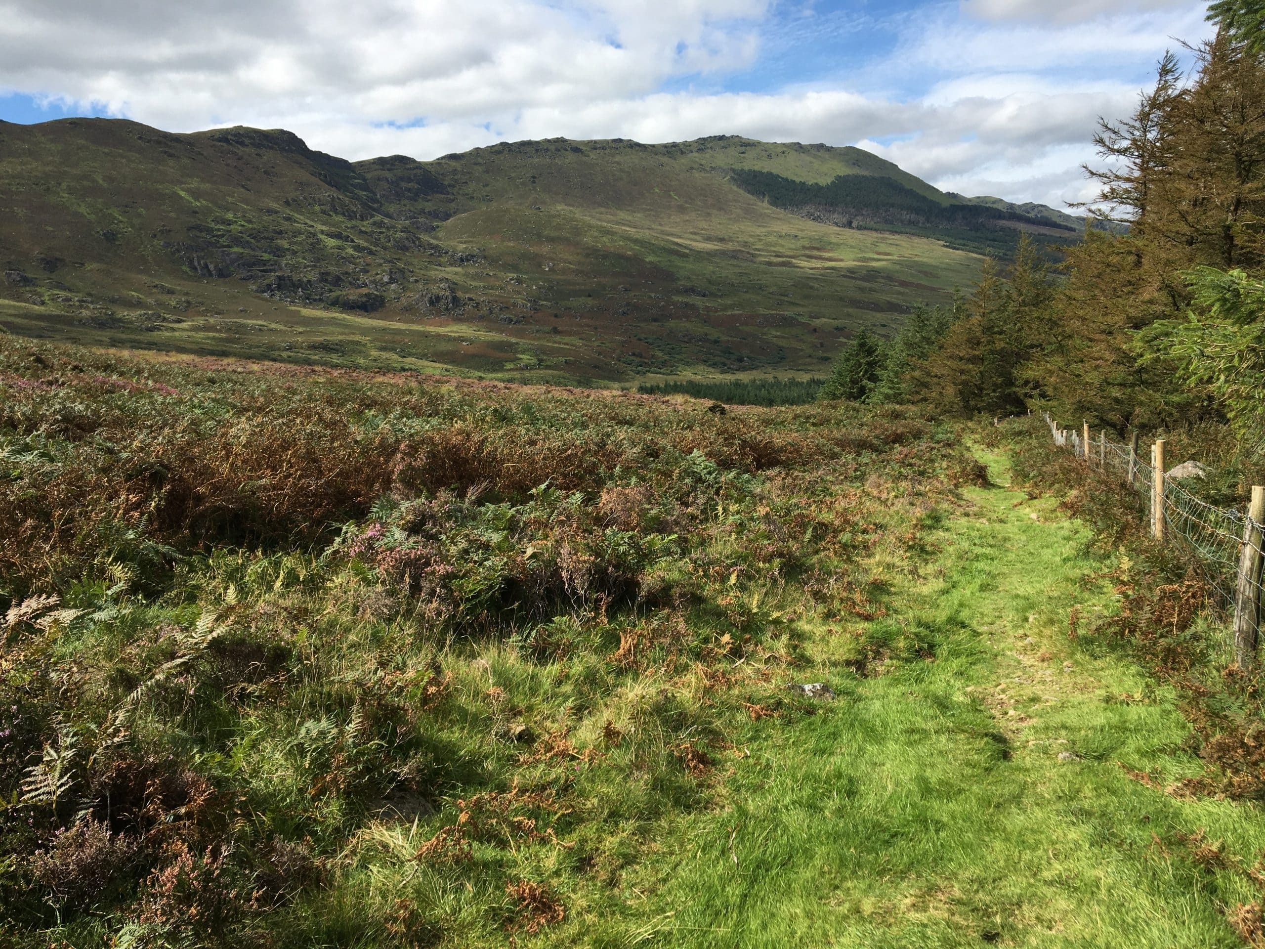
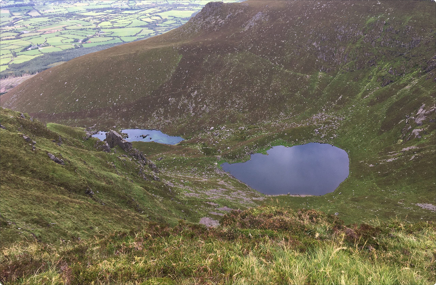
The Comeraghs Mountains, which means place of the hollows or ‘Coums’, form part of the North Munster fault line along with the Galtees, Knockmealdowns and Slievenamon. All of these armorican fold mountains run East/West. The name Nire Valley comes from the Irish Gleann na hUidhre, which probably means glen or valley of the yellow/brownplace or cow. The area known as the Nire, lies on the western side of the Comeraghs and hosts a treasure trove of coums and lakes. There are four marked walks of different lengths in this trail network. Three of the four coums in the area contain six of the Comeragh’s thirteen lakes. Coumlara which is the Coum nearest The Gap, is the Nire’s only dry coum. The Gap is a natural pass in the Comeragh Mountains and has been used through the centuries. The road through The Gap linking the Nire Valley to Rathgormack is called Bóithrín na Sochraide (The Funeral Road). On the Coumduala Loop, as you walk along the ridge to your right (south east) you should be able to pick out Tramore Bay, Hook Head, TF Meagher cable-stayed bridge, Kilcash, Slievenamon, Mt. Leinster and the Blackstairs Mountains. While on your left (south west) you should see down to the coast near Ardmore.
How to Get There
From Dungarvan follow the signs for the N72 west in the direction of Cappoquin/Lismore. At the Master McGrath Monumentturn right onto the R672 in the direction of Clonmel. In the village of Ballymacarbry turn right toward Knockaun. Proceed along this road in an easterly direction for about 4km until you come to a bridge. At this point take the right fork before you cross the bridge and continue on for about a further 4km, past the Nire Church and Hanora’s Cottage until you come to a car park (52.267° N 7.595° W) on your left hand side. From Clonmel take the R665 in the direction of Ardfinnan. Turn left onto the R671 at Kilmacomma in the direction of Ballymacarbry/Dungarvan. At Ballymacarbry turn left. Proceed along this road in an easterly direction for about 4km until you come to a bridge. At this point take the right fork before you cross the bridge and continue on for about a further 4km, past the Nire Church and Hanora’s Cottage until you come to a car park (52.267° N 7.595° W) on your lefthand side.
Did You Know
- Before 1862 there was no parish church in the Nire and this necessitated bringing the dead across The Gap-‘Bóthar na Sochraide’ for burial in Rathgormack. Though the Nire Church was completed in 1862, it would be 1926 before the graveyard was used to any extent.
- The Sgilloges are two of the six lakes in the Nire Valley. You will see a waterfall cascading from the top of the mountain on the back wall of the first lake. This waterfall is called “Bean Píobra” which means “Woman with the Pipe”. It has been given this name because when the wind blows from the south west, the water is blown back over the waterfall, and from a distance it looks like smoke rising.
- Not every coum has a lake. Coumlara is one of the Comeragh’s best examples of a dry Coum–a hollow with no lake. Coumlara itself means, “hollow where the river forks”, as ‘Lara’ or ‘Ladhar’ (pronounced ‘lyre’) in Irish, is the piece of ground at the confluence of two rivers.
Walk details
Nire Valley Map
144.18 KBTrail name
Gap Walk
Sgilloges Walk
Coumlara Loop Walk
Coumduala Loop Walk
Grade
Moderate
Strenuous
Strenuous
Strenuous
Distance
5.5 return
6.5 km return
7 km
7.5 km
Type
Linear
Linear
Loop
Loop
Estimated time
2 hours
2-2.5 hours
3-4 hours
3.5-4.5 hours
Ascent
230 metres
320 metres
290 metres
415 metres
Terrain
Hill & mountainside tracks, green paths
Way marking
Green arrows
Blue arrows
Red arrows
Purple arrows
Parking & trailhead
Nire Valley Car Park, Knockaffrin
Trailhead grid ref/GPS
S 277 128; 52.25704, -7.59515
Nearest town/village
Ballymacarbry
Minimum gear
Hiking boots, water/wind proof jacket, fluid, snack, phone
Overview
The Nire Valley is a treasure trove of coums and lakes and is a fantastic area for a variety of walks of different lengths.
Related experiences


Location
type
Grade
distance